STAY ON TN58 and SEE...
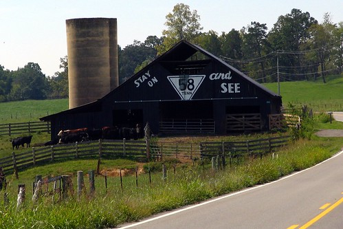
 igh visibility of a bend in the highway makes this a prime location for a Rock City Barn. Then, add to that the thought of staying on the same road for another hundred miles, and you are there. This Rock City barn is on state highway TN58, just south of Kingston in Roane County, and runs all the way into downtown Chattanooga. From there staying on TN58 may be difficult, because it meets up with the multiplex of US11/US41/US64/US72, but the signs for Rock City are, of course, everywhere, and you can't miss it. South of downtown Chattanooga in the St. Elmo community, TN58 is one of the two primary routes to ascend Lookout Mountain. Known as "Ochs Highway", named for Adolph S. Ochs (who helped develop Point Park at the northern end of the mountain), the highway becomes GA157 at the state line and Red Riding Hood Trail takes you to the Rock City entrance.
STAY ON 58 TENN. and SEE
ROCK CITY
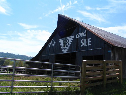
As you can tell, the ROCK CITY part is now missing. Something has happened to it in the last 10 years. (The bottom of the TN58 Triangle was part of this section, also.) I suppose that would be strange if you were driving this highway, and didn't know what to make of it. The 5 of 58 looks here like the paint has faded, but there is actually a mesh Christmas light in front of it. Also, some of the boards on the right appear to be loose. Here is an alternate view:

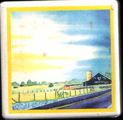
The last time I was at Rock City, I bought art of this barn on a magnet. The magnet style is now discontinued and was in the discount section of their store across the street. The art here is a painting from the Anita Armstrong Capps book, but cropped and condensed to fit on a 2"x2" magnet. I like how the road plays a prominent part in this painting, because the barn at the curvature in the road is what made this an ideal Rock City barn in the first place.

In the Jenkins Book, featured on page 150A.
On OhioBarns.com, is RCB42-73-03. The photo there is 4 years old and the part with ROCK CITY is still there.
See it on a map HERE.
Lat & Lon: 35.7821oN \ -84.5799o W


0 Comments:
Post a Comment
<< Home