Changes and Preservation
 hange happens. People move from the country to the city. Companies go out of business. Industries become less important. Traffic patterns change. Highways get more traffic than they can handle. In the case of Brown County, Ohio, two U.S. Highways change their route. Left behind is a Rock City barn that hasn't been updated in decades.
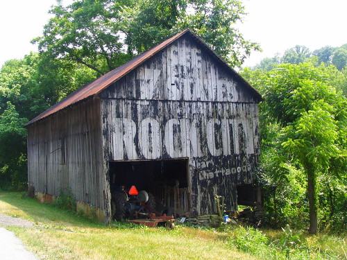
SEE
7 STATES
FROM
ROCK CITY
Near
...............Chattaooga
.....................................Tenn.
7 STATES
FROM
ROCK CITY
Near
...............Chattaooga
.....................................Tenn.
At some point, It was decided that since both U.S. Highways 62 and 68 are both going to Ripley, that they should be merged together and form one bigger highway to accommodate the rising traffic demands of both. A couple miles north of the town square in Georgetown, OH, U.S. 68 is routed to the east of town. Several miles down the road, it multiplexes with U.S. 62 and heads towards Ripley, OH. When it was just U.S. 62, the highway ran strait into Ripley and became Main St. However, with the increased traffic, the new highway runs mostly parallel with the old one and gets to Ripley a couple thousand feet on the east side. I am not sure when the change was made, but the oldest map I have of the area, made in 1966, doesn't reflect the update.
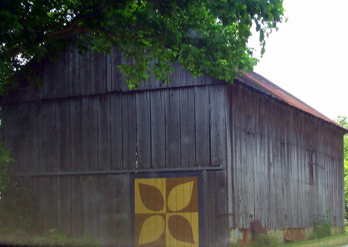
What do you see, when you drive the old main street out of Ripley along this once important road, but is now nothing more than a residential street? There's a run down vacant hotel. You see an abandoned gas station. It's mostly houses. The area is too hilly to have any kind of farmland, yet there is a barn. Perhaps a petter description would be a shed. This is the view you get when coming from the south. (The first thing you'd notice about this barn is the quilt pattern.)

This barn is big enough for a good lawnmower. The land it's on isn't even flat. If you look closely at the first picture, the front center support as well as the front right corner is held up by a stack of rocks! It makes me wonder if the right half of this barn is even usable for anything.
Even more curious is something that made me take a second look when I was re-examining the pictures at home. The word Chattanooga is misspelled! The "n" is missing. The word there is Chattaooga. Is this a mistake? Quite possible, but you can't quite assume that either. There were stories of one of the Mail Pouch Tobacco barn painters who would intentionally misspell a word. He would wait to hear from the corporate office to see if any of the locals was paying attention and report the mistake. When the misspelling was (usually) reported, the painter would revisit the barn and repaint the word to correct it. Did that happen here? I don't know. Maybe "Chattanooga" wouldn't fit in the allotted space.

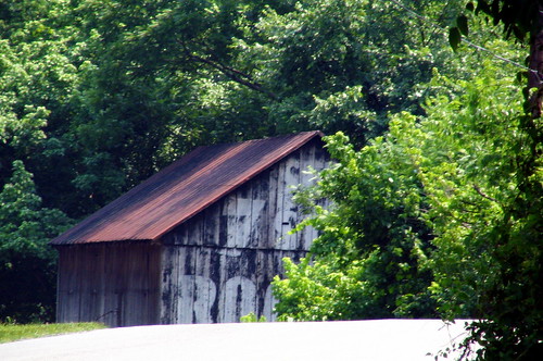
One final view of the barn to share is this view. When traveling southbound on old U.S. 62, this is the first look at the barn you'd get along the windy and hilly road. The top of the barn comes directly into view strait ahead. Then you drive over the top and the road veers to the left.
On OhioBarns.com, this is designated as #RCB 35-08-01.
In the Jenkins book, this is on page 81 (in the book in the 1995 picture, the weeds were so tall in front of the opening to the barn, it was probably difficult to get the mower out.)
To see it on a map, click Here.
Lat & Lon: 38 46.05oN \ 83 48.96oW


1 Comments:
I am new to your blog and have to tell you how inspired I am by your tenacity. I visited Rock City with my husband and our friend several years ago and was instantly addicted to all things "Rock City". Thanks for a wonderful blog that leaves me thinking about my great memories of rock city.
Post a Comment
<< Home