The Birdhouse Barn near Rock City
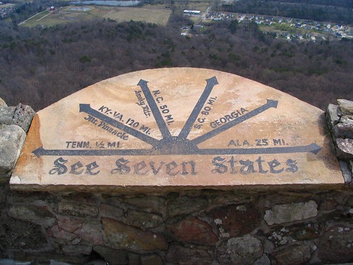
 ne Rock City barn can be seen from Rock City, but it hasn't always been there. One of the bigger draws to rock city is the claim you can see seven states from the Lover's Leap overlook. You are in Georgia, while Tennessee is not far to your left, while Alabama is just a few miles to the right. The Carolinas are many miles strait ahead, and it is debatable that you can actually see Kentucky or Virginia. If you look down, you will see the tops of trees down the side of the mountain until it gets to the flat area at the bottom. There are several fields while the Chattanooga Valley Highway (GA 193) runs parallel with Lookout Mountain.
The Rock City people have bought one of those fields, the one which appears in the top left corner in the picture below. Every year during the autumn season, they have a maze grown out of stalks of corn, which they call The Enchanted Maize. In that field is a rock city barn, which only looks like a white dot on a black speck in the first picture.
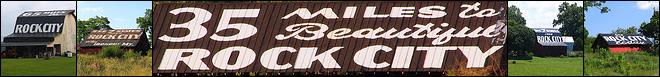
The sale of Rock City birdhouses have now complemented the painting of barns for their advertising. The concept was originated by the Barn painter Clark Byers who, along with his son, first painted this barn in the late 60's. It was originally located just off Interstate 75 in Dalton, Ga, however the overgrowth of trees made it difficult to see from the freeway, unless you stopped at just the right spot. (Here is an example photo of a birdhouse.)
Not too long ago, the church that owned the property decided to expand their building, but to do this, they needed the land where the barn was located. Before they could raise the barn, the Rock City people stepped in to preserve this one-of-a-kind and relocate it to where it stands today.
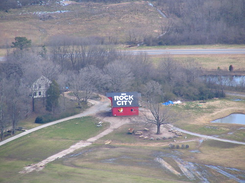
This second photo is a zoom in from the first picture's vantage point.
OhioBarns.com designates this as #RCB 10-155-01
(listed in Whitfield County here, but now is actually located in Walker County)
The Jenkins Book: page 119. The Picture from the book appears on the Rock City website. See it Here.
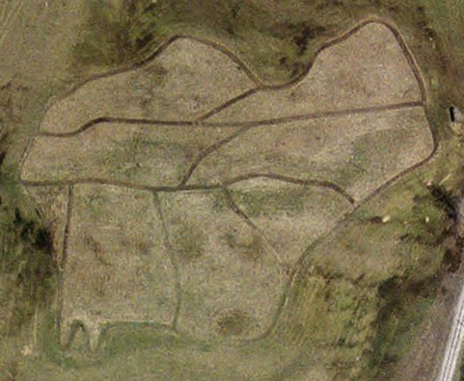
See it on a map HERE. You might notice in this overhead picture that the image "grown" in the field is the shape of the seven states listed in the sign from the first picture. If this overhead picture ever gets refreshed, it might be something else.
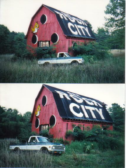
Here is one more picture in the old location. (the photographer likes putting his truck in pictures)
Here is a great photo in the new location of a kid walking through the maize with the barn in the background.
Lat & Lon: 34o58'42.28" N / 85o20'05.20" W
posted by BrentKMoore at 2:31 PM
![]()
![]()


0 Comments:
Post a Comment
<< Home